Sustainable Community Design on Vancouver Island, The Jubilee Heights Model
What sustainability actually looks like on the ground – from trail networks and tree retention to stormwater, complete streets, and why it matters for daily life.
Sustainable community design is one of those phrases that appears in almost every new development’s marketing material and means almost nothing without specifics. This article explains what it means at Jubilee Heights in Campbell River – the actual design choices made, why they were made, and what they mean for the daily life of someone building or buying there. It is not a principles document. It is an explanation of a specific place.
Trail Connectivity: The Design Choice That Changes Daily Life
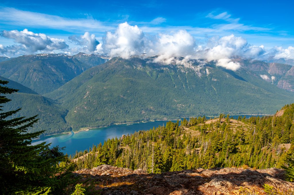
The most consequential sustainable design decision at Jubilee Heights is trail connectivity – specifically, the decision to connect the internal trail network to Beaver Lodge Forest Lands and the broader Campbell River trail system rather than treating it as a standalone amenity.
Beaver Lodge Forest Lands is a 416-hectare managed forest inside Campbell River’s city limits with approximately 40 kilometres of trail. It is one of the few places on Vancouver Island where a family living in a city neighbourhood can step off their street onto a forest trail network without a car trip. Jubilee Heights’ trail connections make that access real from Jubilee Parkway – not advertised as an aspiration but built into the street and open space network.
The daily life implications: a parent can walk a child to a trailhead instead of a screen. A remote worker can do a 30-minute forest reset at noon. A retiree can build a morning walking routine that does not require driving. These are not extraordinary activities. They are exactly the kind of routine that makes a neighbourhood feel livable on an ordinary week.
The Commercial Village: Walkable Errands as Infrastructure
The Jubilee Heights Commercial Village is being developed by Royop Development Corporation – a commercial developer with a BC portfolio that includes neighbourhood-scale retail and service centres. The planned uses include grocery, café, dining, and daily services. The location within the Jubilee Heights community is designed so that residents can reach it without a car.
This is the specific element that separates a genuinely walkable community from one that is designed to look walkable. Trail connectivity is necessary but not sufficient – you also need a destination. The Commercial Village provides the destinations that make short walking trips functional: coffee before work, groceries after school pickup, a quick lunch. Without it, trails are recreation infrastructure. With it, they are also daily life infrastructure.
The Commercial Village distinguishes Jubilee Heights from most Campbell River residential developments. Other subdivisions have trails, parks, and serviced lots. Jubilee Heights is the only master-planned community in the area being built with a dedicated commercial node designed for neighbourhood-scale daily service.
Stormwater Management: What It Means in Practice
Campbell River receives significant rainfall, particularly in fall and winter. Stormwater management at Jubilee Heights is designed to handle peak rainfall events without flooding streets or overwhelming the downstream municipal storm system. The approach uses curb and gutter, catch basins, and a detention pond system sized for the community’s impervious surface area.
For individual lot owners, the practical outcome is a driveway and yard grading plan that moves water away from the foundation and toward the street drainage system rather than pooling against the house. The community’s stormwater design means that heavy rain events are managed by infrastructure, not by hoping the lot drains itself.
The specific relevance for buyers considering basement development: the stormwater system and individual lot grading were designed with the assumption of a built lot, not a bare lot. Grading plans are available from Couverdon’s team and should inform the siting and foundation type decisions your builder makes.
Complete Streets: The Safety Detail That Families Notice
Complete streets is a design standard that provides for all users of a street – pedestrians, cyclists, and vehicles – rather than optimising for vehicle throughput alone. At Jubilee Heights, this means sidewalks on both sides of residential streets, marked crossings at intersections, street lighting to a standard that makes evening walks safe, and block lengths designed to create short, direct routes between destinations rather than forcing pedestrians onto longer paths.
The beneficiaries of this design who notice it most immediately: children walking or cycling to school, parents with strollers, and older residents whose confidence in outdoor movement depends on whether a sidewalk exists and whether the crossing is clearly marked. These are the details that make a neighbourhood genuinely walkable rather than technically described as walkable.
Tree Retention and Planting: The Character That Takes Years to Build
The forested character of Vancouver Island’s residential neighbourhoods depends on tree retention during development and replanting after construction. Jubilee Heights’ site planning retained existing trees where grading and servicing allowed, and the street tree program adds canopy along the street network that will mature over the life of the neighbourhood.
The practical effect in the near term is modest – a newly developed area always looks more open than an established neighbourhood. The relevant question is whether the framework is in place for the neighbourhood to develop the tree canopy that defines the Island’s residential character. At Jubilee Heights, it is. Building lot owners can also contribute to this with lot-level planting that will mature in tandem with the street trees.
Energy Standards: What the Building Scheme Requires
Jubilee Heights’ building scheme and the City of Campbell River’s current energy requirements reflect BC’s Energy Step Code framework. New homes built in Campbell River must meet Step Code performance targets, which in practical terms means:
- Air tightness testing at framing and occupancy – the home’s airtightness is measured, not assumed
- High-performance windows that exceed base code minimum values
- Mechanical ventilation with heat recovery – fresh air exchange without losing heat
- Heat pump readiness or installation – the dominant low-carbon heating choice in BC’s climate
Buyers comparing Jubilee Heights homes to older Campbell River resales will notice the operational difference in heating and cooling costs, indoor air quality in wildfire smoke season, and noise reduction. Step Code-compliant new builds perform measurably better on all three.
Why the Mosaic Forests Connection Matters
Jubilee Heights is developed by Couverdon Real Estate, which is part of Mosaic Forest Management – a private forestry company that manages over 315,000 hectares of Vancouver Island forest land under a long-term sustainable forestry mandate. That context is not just brand background. It informs the development approach: Couverdon builds communities that its parent company plans to be connected to this land for decades. That produces a different time horizon than a developer who builds, sells, and moves on.
It also produces a specific credibility on environmental design questions. A company that manages forest land at scale understands riparian protection, stormwater, and habitat better than most residential developers. The sustainable community design at Jubilee Heights is not a marketing layer applied to a standard subdivision – it is the result of an organisation that thinks about land differently.
Explore Jubilee Heights
→ View available Phase 5 and Phase 6 lots
→ See the site plan and trail connections
→ Contact our team about the community and available lots
Frequently Asked Questions About Sustainable Community Design at Jubilee Heights
What trails are accessible from Jubilee Heights?
The Jubilee Heights trail network connects to the broader Campbell River trail system and provides access to Beaver Lodge Forest Lands – a 416-hectare managed forest with approximately 40 kilometres of trail inside city limits. Trail proximity and connectivity are part of the community design, not a future plan.
What is the Commercial Village at Jubilee Heights?
The Commercial Village is a neighbourhood-scale commercial development within Jubilee Heights, being developed by Royop Development Corporation. Planned uses include grocery, café, dining, and daily services. It is designed to be accessible on foot from residential lots in the community.
Does Jubilee Heights meet BC Energy Step Code requirements?
Yes. New homes built at Jubilee Heights must comply with the City of Campbell River’s energy requirements, which reference BC Energy Step Code performance targets. This means homes are tested for air tightness, must meet high-performance window standards, and are typically built with heat pump heating. Your builder can confirm the specific step requirement and how it is verified.
What stormwater management features exist at Jubilee Heights?
The community has a designed stormwater system including curb and gutter, catch basins, and a detention pond system sized for the development’s impervious surface. Individual lots have grading plans that direct surface water away from foundations and toward the street drainage system. Couverdon can provide grading information for specific lots.